

Climbing Windward Olympus | O'ahu, Hawaii
- Nandor Szotak

- May 5, 2020
- 5 min read
Updated: Sep 12, 2024
By Nandor Szotak - May 2nd 2020

I didn't do a new, exciting so-called extreme hike for a while. I was more occupied with peak bagging, hiking other trails, and lately got into creating YouTube videos for a new challenge I set for myself, climbing Hawaii's 100 Highest Peaks. All those peaks could be a good motive to write blogs, but I still think I am a better video creator than a writer. I am more of a "documenter" if that word exists.
Okay, so a little bit of history about Windward Olympus. This trail was pioneered by old-school HTMC (Hawaiian Trail and Mountain Club) hikers, and the route they set is called unofficially the Turner Route, named after Dayle Turner HTMC member, who lead the actual hike. After that, Pete Clines and his team made an ascent on a little bit different route, and that is called unofficially the Cline's Route. Both routes join at the same spot up higher on the ridge but have different starting points.
After them they were 2 other groups who made the ascent, both using the Turner Route.

My friend Scott was in one of the groups who climbed this route, so I was exchanging some information with him about the hike months ago, and he even showed me his Gpx track which I could examine a couple of times before our attempt.
Was not a lot of planning on this one, I was just asking a couple of friends if they want to do a hike on the weekend. That's it. Windward Olympus, here we come!
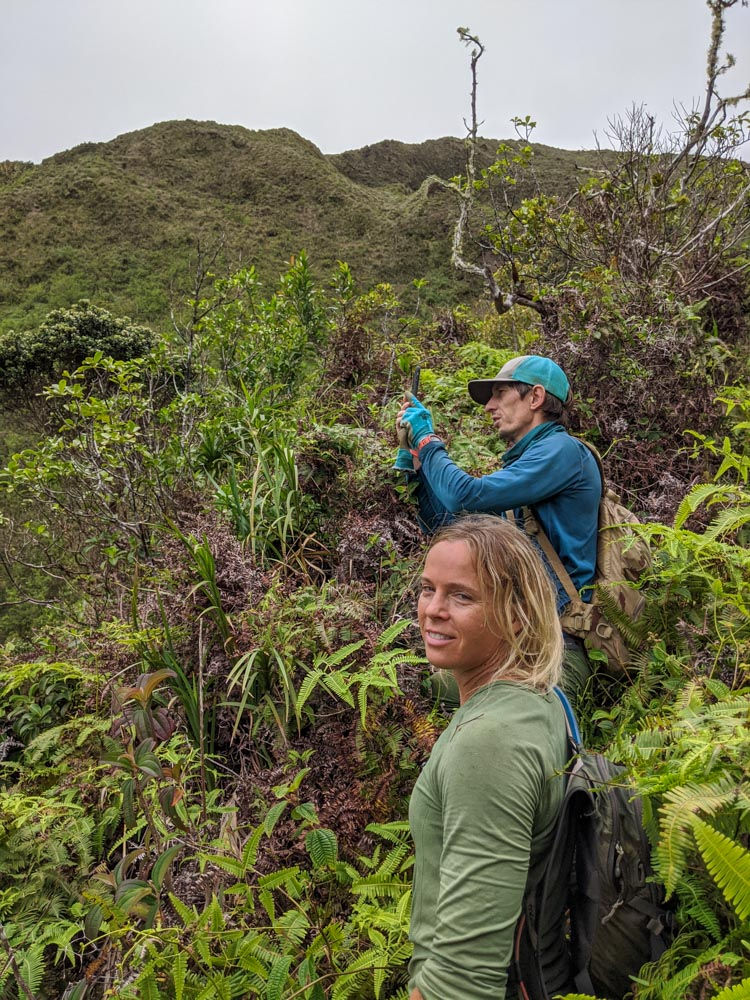
Initially, we had a group of 4 people: Stacy, Steve, Ben, and Me. Ben called in sick in the morning, so only 3 of us met in Maunawili, where we started our hike.

We used a shortcut trail from Steve's friend's house up to the Maunawili Connector trail, and from there we hiked along the Maunwili Demo trail until we reached our ridge.


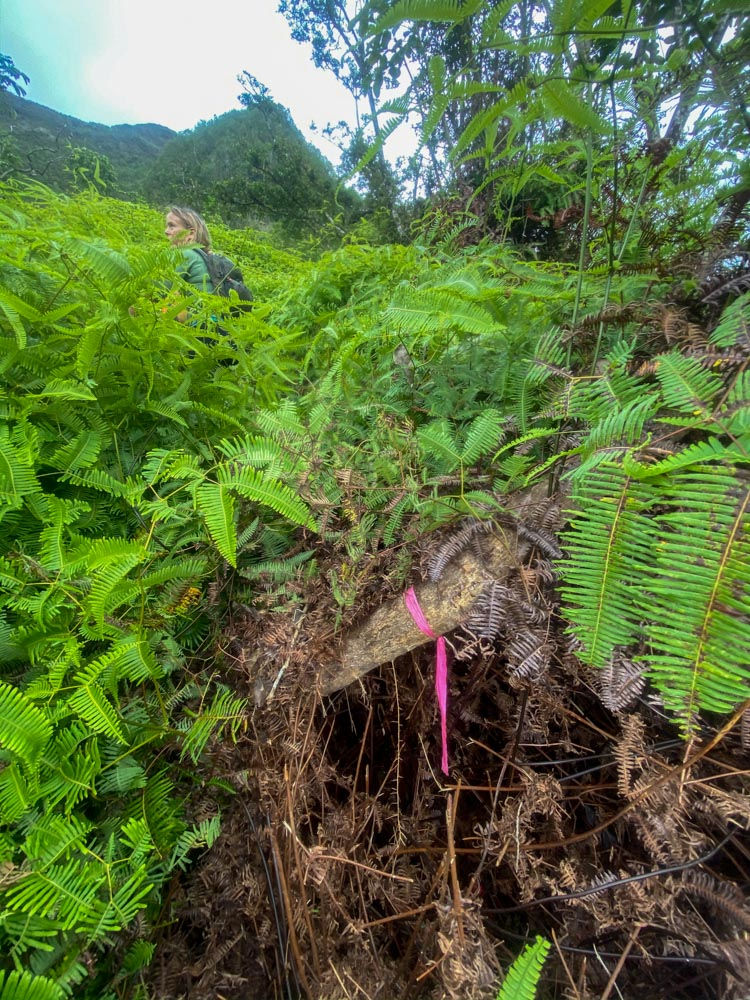
After 3 miles of walking, we checked our maps and decided to jump in the uluhe on a nice graded spot. The next 0.4 miles was a continuous bushwhack through thick ferns. We didn't stop until we reached the bottom of the hill (picture below). We thought naively that after the "uluhell" is over, we will have an easier time navigating uphill through the trees.

While getting closer to the hill in front of us, we found some good-looking pink ribbons, possibly leftover from Scott's group from a couple of years ago. Pink ribbons made Steve happy because he was getting worried that we might lose the trail. What trail?
After like 45 minutes the uluhe turned into something else...Well, let's just say that this section was one of the worst if not the worst part of the whole climb. It was a lot of thick vegetation, dry, rotten trees, invasive clidemia, ie'ie plants, and their vines constantly blocking our way. On top of that in one section we even encountered a lot of cat claw with its nasty thorns.
As we were moving in this section, the terrain started to get steeper until at one point we hit a rock wall. Stacy tried to look for a way to go straight up, but it wasn't an option. We had to go right to contour somehow the wall until we could climb up safely.
Safely is a loose term, but you guys know what I mean :)
After 10 minutes of looking around and contouring, we just decided to go for it. We were ascending tree by tree on an almost vertical terrain with loose rocks under our feet. It was a full-body workout that required constant attention, and "rock yelling", but we made it up safely to the top of the steep hill. This section was so bad, that none of us even thought to take a picture!
It was time for a short break after that exhausting approach. 1700ft high but we could see already the summit of Mt Olympus (2486ft). We knew at this moment, nothing can turn us back!

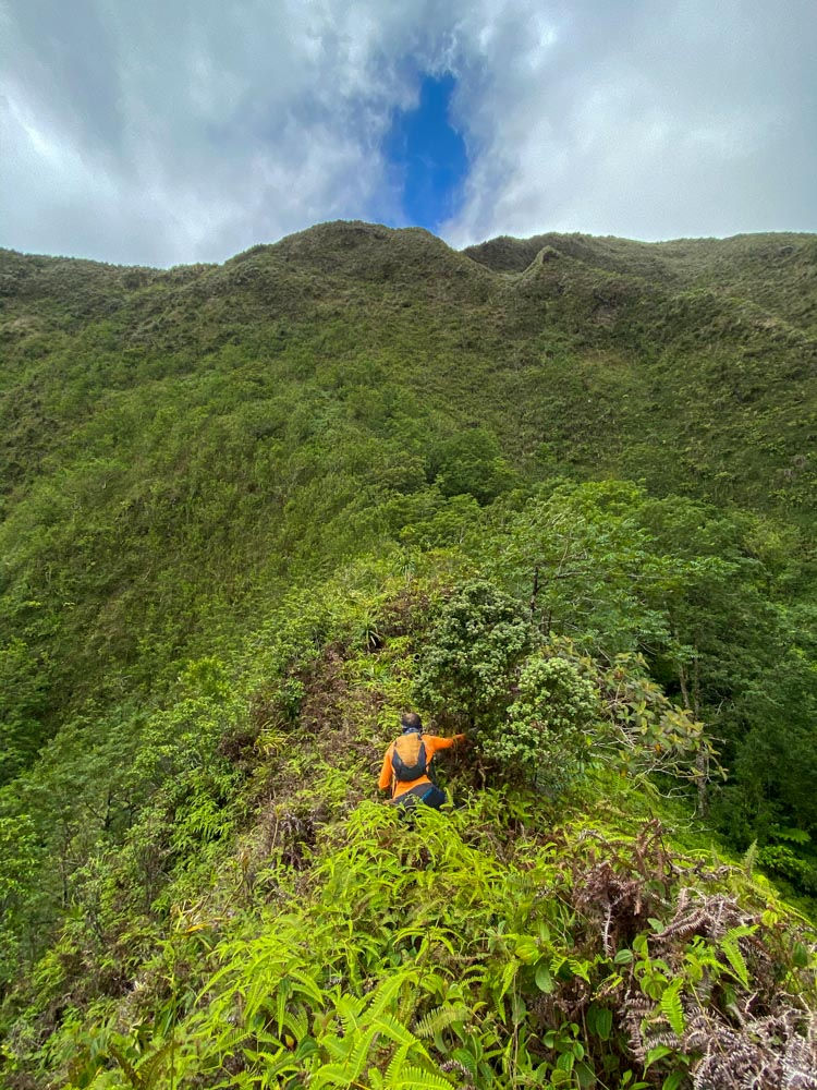
After the break, we discussed our next move. The smartest thing was to push towards that little lip/line-looking formation carved in the mountainside. (see picture below)

It looked like that if we reach that part, we could contour on the left and have a better look at the remaining of the climb. None of us knew at that moment that after the contour we will be almost on the KST.
Steve was in front pushing through the mixture of trees and ferns. When the uki grass showed up, we knew that the real grass climbing will start soon. Maybe too soon...
The last little section to reach the lip was a pretty vertical climb on the crumbly ground. It was muddier than the lower parts, and even the uki grass was unstable.
I found myself pulling onto this thin spiderweb-looking grass, laying flat on the ground while trying to juggle my body weight to my advantage. Thankfully we were all lightweight climbers. Surprisingly I was the heaviest in the group with 141 lbs :)

After some hustle, we reached the "lip", where we took a nice little break.
Meantime I got a message from Alex (who was invited to the hike, but he couldn't make it) that two of our friends were hiking Mt Olympus today, and they have extra ropes if we need help on the final ascent. Most of the other groups who had done this hike before, needed some webbing/help to climb the last section. That gave us some extra positivity for the end!
The "lip" was like a little faint trail on the side of the mountain, so the plan was to follow it. I was heading out first, slowly contouring the mountain. None of us looked back down. I still don't know how is that view from 2200ft high, while hanging on a piece of grass. Next time.
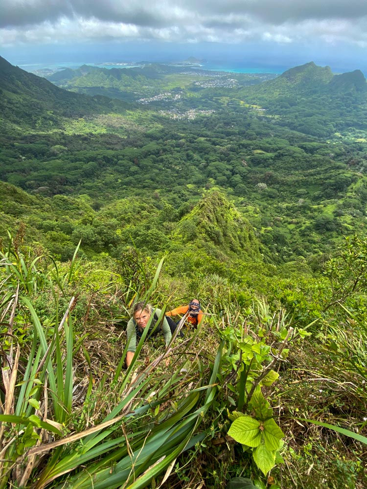
Less than 10 minutes of contouring and we found ourselves in a position of "where now". Drastically the wind picked up, which was very weird. Almost blew my hat off a couple of times. At that moment I was 99% sure that we are reaching the trail, the KST (Ko'olau Summit Trail) if we climb just that extra 10 ft. I threw my hat up into the bushes and was trying desperately to find a way up. The vegetation was very rare, with barely any grass to hold onto, wherever I stepped I was sliding back. Somehow I found a somewhat good hold and pulled myself up landing on the trail! I was concerned that I destroyed the way behind me, but Stacy and Steve both managed to climb up without any help.

We made it!
Without any break, we continued to the lookout of Mt Olympus where we sat down, and enjoyed our well-deserved lunch!
Checking the time I was surprised at how fast we made it up to the actual
Mt. Olympus peak, 3h55min.


After lunch, we headed out on the Wa'ahila Rdige trail, but on the way, we met Becca and Justin who were getting ready the ropes to help us on the last climb. I guess we made it without it, but we were happy to see them.


The hike down was fast. I think Steve wanted to break some record or something because he was flying down.
We safely made it down Kolowalu Trail with a smiling faces.
All of us felt accomplished!

Mahalo Steve for taking most of the pictures!
Team: Stacy, Steve, and Nandor (Me)
Distance: Around 7 miles
Hiking Time: 5.5h
Please don't use this documentation as a guide for your future hiking activities. This hiking route it's unsafe and very dangerous, mistakes made up here can have consequences such as serious injury or death. Make sure you know your limitations and be safe out there!
Tags: #hiking #hawaiihiking #extremehiking #adventures #windwardOlympus #koolaumountains


Wasn’t expecting to see this write up! Thank you for. Sharing! Brings back memories of clinging to Adrotina for dear life, back in 2010 I think …….
You still out there Koolau Jim ? ;) thanks for the inspiration!
Mahalo Dayle! You guys are always my inspiration when I set myself to do a new exciting route up the Ko’olaus. I enjoy reading your write ups, and all the adventures you did!
Enjoyed the write-up and pics of your Olympus Windward adventure. It brought back memories of 2002. Mahalo, Nandor!